SUMMARY
This is AI generated summarization, which may have errors. For context, always refer to the full article.
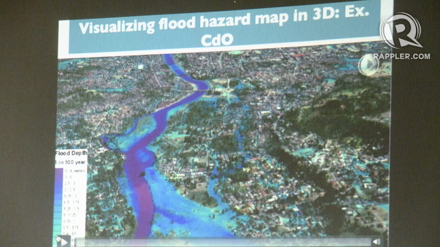
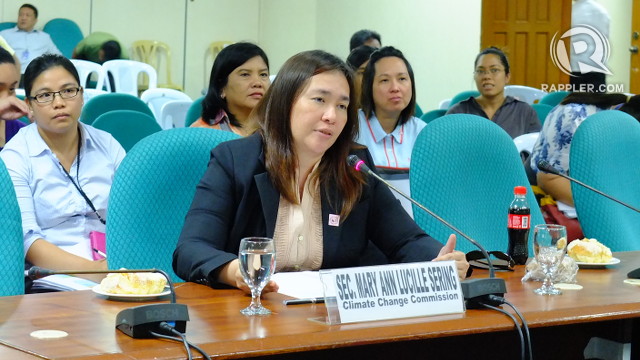
MANILA, Philippines – At the September 13 budget hearing of the Climate Change Commission, Secretary Mary Ann Lucille Sering unveiled a climate change map of Cagayan de Oro, one of the most disaster-prone cities in the country.
The 3-dimensional map is “the first of its kind in the Philippines,” according to Sering, and was finished within a record span of 6 months with the help of the local government, the Department of Science and Technology, National Mapping and Resource Information Authority (NAMRIA) and Project NOAH.
Attached to the Office of the President, the Climate Change Commission is the government’s policy-making body tasked with coordinating and evaluating climate change programs and action plans.
Unlike geohazard maps which document only the geology, landforms and slopes of a particular area, climate change maps plot out impacts of climactic event factors like rainfall, humidity, chances of erosion, ground water potential and soil texture, among others.
Specifically, the CDO climate change map foresees what will happen to the province when besieged by a storm in 2020 and 2050 given the compounding effects of climate change.
“This is the first map of its kind that factors in climate change scenarios by 2020 and 2050. This is an actual flood map of Cagayan de Oro,” explained Sering.
Wonder map
In 2011, more than a thousand people died when flashfloods submerged CDO during Tropical Storm Sendong. But information provided by the climate change map can stop flashfloods from ever happening again, said Sering.
The map identifies areas most vulnerable to flooding measured by gradience in color–the darker the hue, the deeper the flood in the area.
It can help local government units and private citizens know when relocation is necessary. If the storm will only flood in the area, only proper flood control is needed and not necessarily relocation. But if the map shows the area is vulnerable to soil erosion and landslides, recommendations for relocation can be made even before the storm hits and lives are lost.
It can also measure the effectiveness of infrastructure projects meant to alleviate flooding.
“If we now factor in, for example, drainage system, we will run this again and we will see how it will be reduced,” Sering explained.
By identifying upstream areas where rainwater run-off contributes to the swelling of rivers, the map can help the Department of Environment and Natural Resources identify where to concentrate their reforestation efforts.
“The map allows CDO to identify in a much clearer way the investment and infrastructure it needs to mitigate the effects of climate change.”
Similar maps are being crafted for Iligan, Tuguegarao and Iloilo, added Sering. They hope to replicate the project for the entire country. A climate change map is available for Metro Manila but it was based solely on historical data. The agency hopes to make a more updated version.
Maps that factor in wind velocity are being made for Compostela Valley and Davao Oriental.
“It will now give them an idea, for example, of whether they should still be planting bananas, assuming the wind velocity would be stronger than it is. We didn’t have this before. We would just plant wherever it suited us. But with these tools, we are now putting into context what our investments should be.”
‘Not all about disasters’
But Sering emphasized that climate change is not just about disasters. The country has to prepare for other alarming impacts of climate change.
“We have no idea what an increase in temperature will do to our food security. In areas that we went to, local communities have already cited incidents where there crops are decreasing or wilting. Aside from human activities like overfishing, they’re seeing a reduction in fish yield. We do not have thorough studies on this yet. The Department of Agriculture has been targeting production without looking at the impact of weather and the increase in temperature.”
She added that for 2013, the agency will focus on providing technical advice services to local governments so they can help communities adapt to all foreseen impacts of climate change. – Rappler.com
Add a comment
How does this make you feel?


There are no comments yet. Add your comment to start the conversation.