SUMMARY
This is AI generated summarization, which may have errors. For context, always refer to the full article.
What’s the weather like in your area? Report the situation through Rappler’s Agos or tweet us at @rapplerdotcom.
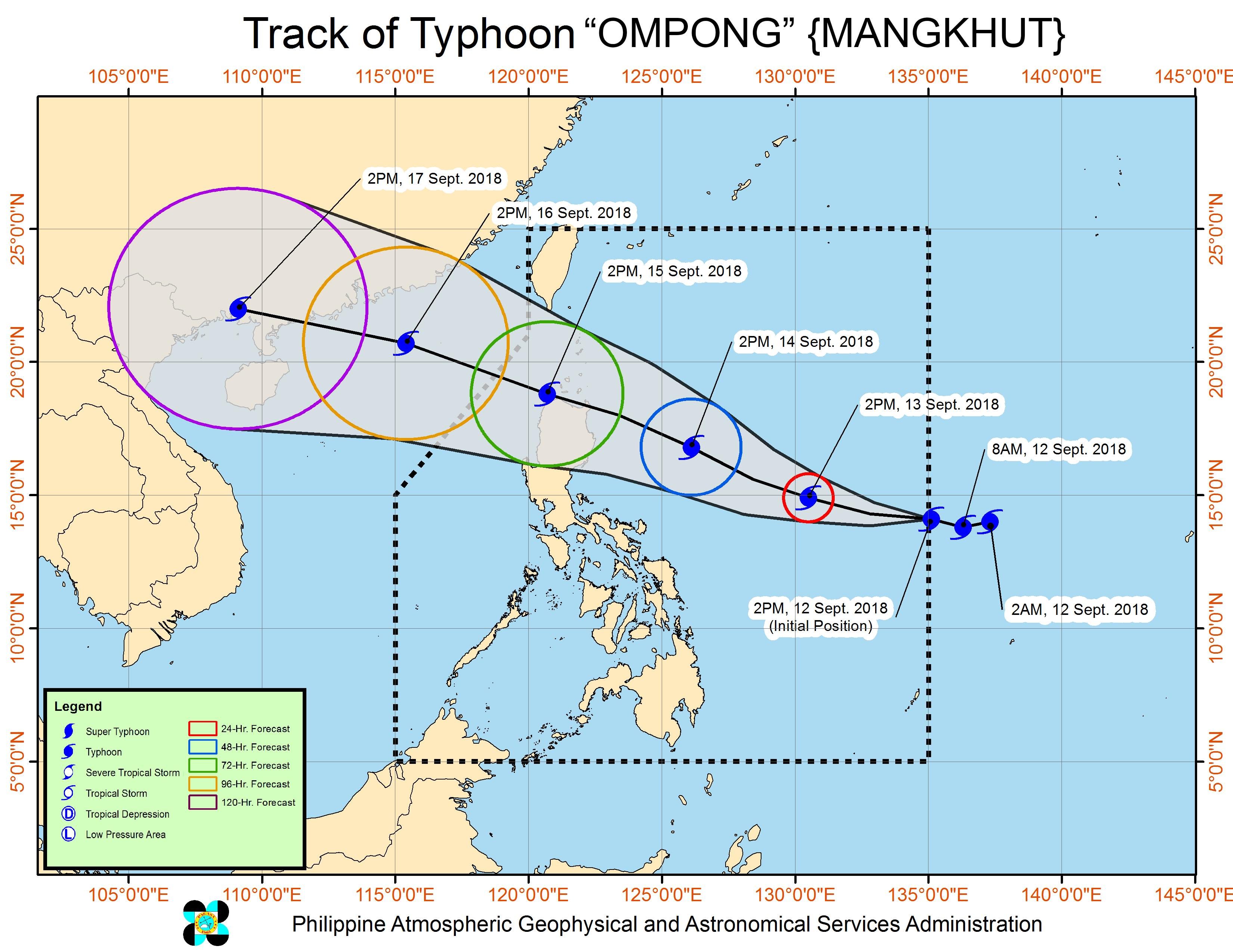
MANILA, Philippines – Catanduanes was placed under Signal No. 1 on Wednesday afternoon, September 12, the first province under a warning signal due to Typhoon Ompong (Mangkhut).
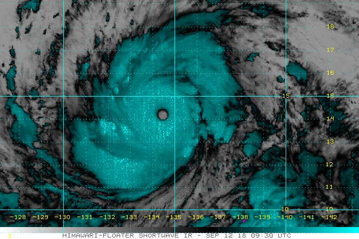
In a bulletin released past 5 pm on Wednesday, the Philippine Atmospheric, Geophysical, and Astronomical Services Administration (PAGASA) said Ompong is already 1,145 kilometers east of Virac, Catanduanes, still moving west at 20 kilometers per hour (km/h).
The typhoon continues to have maximum winds of 205 km/h and gustiness of up to 255 km/h.
Ompong had entered the Philippine Area of Responsibility (PAR) at 3 pm on Wednesday.
PAGASA said Catanduanes, which is now under Signal No. 1, “will experience the peripheral effects of Ompong within the next 36 hours.” There will be occasional rains and gusty winds.
Signal No. 1 could also be raised in Cagayan, Isabela, Aurora, Camarines Norte, and Camarines Sur by Thursday morning, September 13.
On Thursday, Ompong could also reach a peak intensity of 220 km/h in terms of maximum winds and 270 km/h in terms of gustiness. It might become a super typhoon. (READ: FAST FACTS: Tropical cyclones, rainfall advisories)
PAGASA warned there may be heavy to intense rain, storm surges in coastal areas, and very strong winds in Cagayan and Isabela beginning Friday, September 14, and in Northern Luzon on Saturday, September 15.
Ompong might make landfall in the northern tip of Cagayan on Saturday morning.
The typhoon is also enhancing the southwest monsoon or hanging habagat. The enhanced southwest monsoon could trigger moderate to heavy rain in the following areas:
- Wednesday – Zamboanga Peninsula, Northern Mindanao, Siquijor, Surigao del Norte, Agusan del Norte, Dinagat Islands, Lanao del Sur
- Thursday – Palawan, Bicol, Visayas
- Friday – Palawan, Zamboanga Peninsula, Western Visayas, Central Visayas
- Saturday – Palawan, Zamboanga Peninsula, Western Visayas
Residents of areas affected by the southwest monsoon should be on alert for flash floods and landslides, too.
The rest of Luzon, including Metro Manila, might have light to heavy rain with occasional gusty winds starting Friday. PAGASA earlier said Metro Manila could be placed under Signal No. 1 if Ompong’s outer rainbands affect it.
PAGASA also noted that since this is still a “long-range forecast,” it could change. The public should closely monitor updates.
Ompong is the Philippines’ 15th tropical cyclone for 2018. The country usually gets an average of 20 tropical cyclones per year. (READ: LIST: PAGASA’s names for tropical cyclones in 2018)
PAGASA declared the start of the rainy season last June 8. – Rappler.com
Add a comment
How does this make you feel?
There are no comments yet. Add your comment to start the conversation.