SUMMARY
This is AI generated summarization, which may have errors. For context, always refer to the full article.
What’s the weather like in your area? Report the situation through Rappler’s Agos or tweet us at @rapplerdotcom.
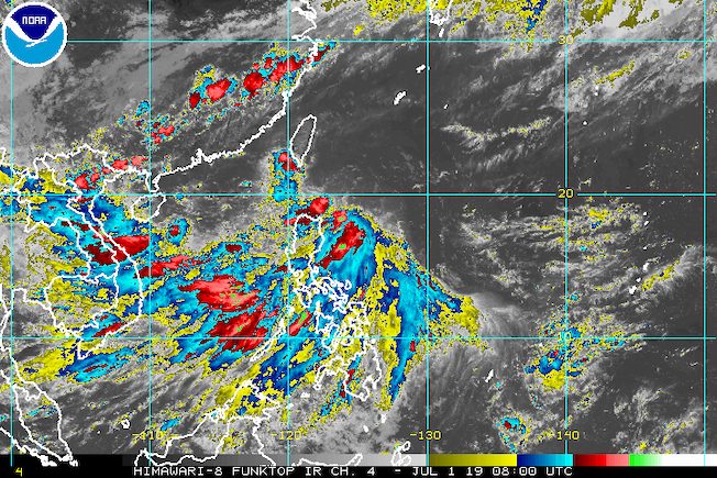
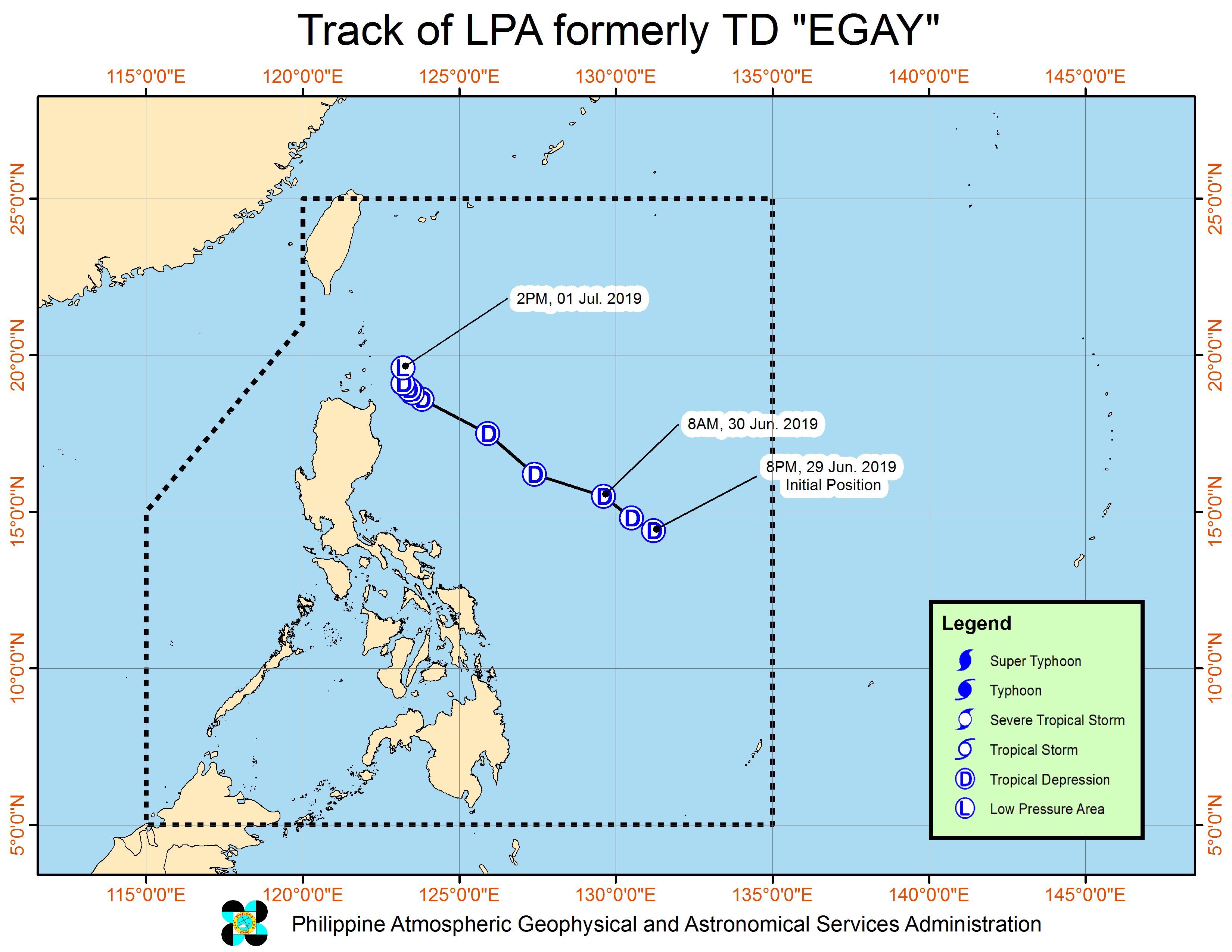
MANILA, Philippines – Tropical Depression Egay weakened into a low pressure area (LPA) at 2 pm on Monday, July 1, but this may bring rain, along with the southwest monsoon or hanging habagat.
In a press briefing at 5 pm on Monday, the Philippine Atmospheric, Geophysical, and Astronomical Services Administration (PAGASA) said the LPA which used to be Egay is already 190 kilometers east northeast of Calayan, Cagayan.
Since Egay has weakened into an LPA, Batanes and the Babuyan Group of Islands are no longer under Signal No. 1. The LPA may also dissipate altogether in the next 24 to 48 hours.
But due to the LPA, light to heavy rain may hit the following areas Monday afternoon until early Tuesday morning, July 2:
- Batanes
- northern part of Ilocos Norte
- northern part of Apayao
- northern part of Cagayan, including Babuyan Group of Islands
As a tropical depression, Egay did not make landfall in the Philippines, but it enhanced the southwest monsoon.
PAGASA warned that the southwest monsoon will still trigger light to heavy rain in the following areas Monday afternoon until early Tuesday morning:
- Metro Manila
- Central Luzon
- Calabarzon
- Mimaropa
Scattered rainshowers and thunderstorms will also persist in the rest of Luzon as well as in the Visayas.
Residents of areas affected by the southwest monsoon must remain on alert for possible flash floods and landslides.
The heavy monsoon rain had prompted class suspensions in parts of Luzon on Monday. (READ: #WalangPasok: Class suspensions, Monday, July 1)
PAGASA also warned that moderate to rough seas will prevail in the seaboards of Northern Luzon and the western seaboards of Central Luzon and Southern Luzon. Those with small seacraft should not set sail.
Meanwhile, PAGASA is also monitoring an LPA outside the Philippine Area of Responsibility (PAR).
This LPA is 375 kilometers west of Ilocos Sur, and could become a tropical depression.
But PAGASA Senior Weather Specialist Chris Perez said the LPA is not expected to enter PAR, and will likely head for China or Vietnam.
Egay was the Philippines’ 5th tropical cyclone for 2019, after Amang in January, Betty in February, Chedeng in March, and Dodong also in June – all tropical depressions as well. (READ: LIST: PAGASA’s names for tropical cyclones in 2019)
The Philippines gets an average of 20 tropical cyclones annually, but since 2019 is an El Niño year, only 14 to 18 tropical cyclones are expected.
Below is the estimated number of tropical cyclones from July to December:
- July – 2 or 3
- August – 2 to 4
- September – 2 to 4
- October – 2 or 3
- November – 1 or 2
- December – 0 or 1
PAGASA declared the start of the rainy season last June 14. – Rappler.com
Add a comment
How does this make you feel?
There are no comments yet. Add your comment to start the conversation.