SUMMARY
This is AI generated summarization, which may have errors. For context, always refer to the full article.

What’s the weather like in your area? Tweet us at @rapplerdotcom.
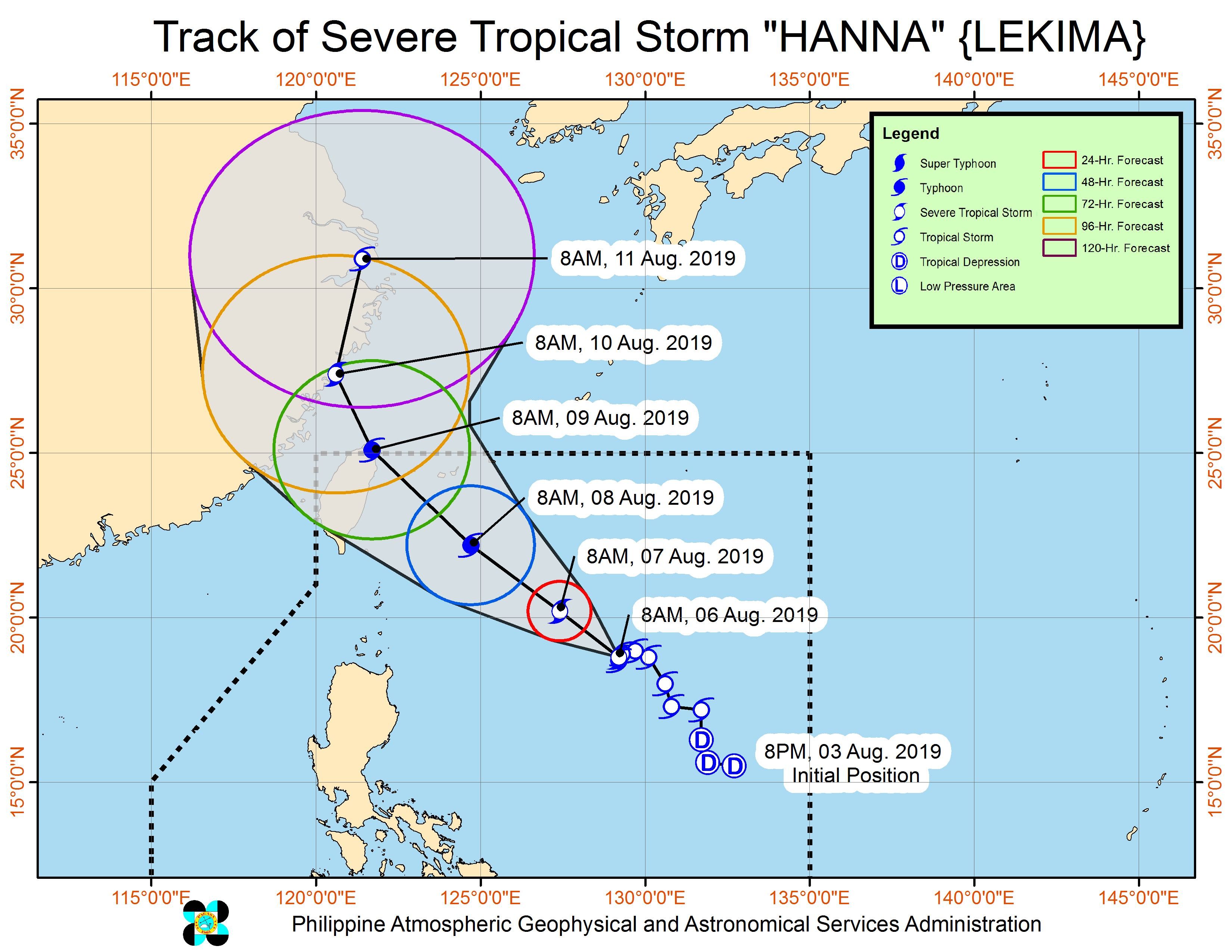
MANILA, Philippines – Hanna (Lekima) intensified from a tropical storm into a severe tropical storm on Tuesday morning, August 6, while still enhancing the southwest monsoon or hanging habagat.
In a briefing past 11 am on Tuesday, the Philippine Atmospheric, Geophysical, and Astronomical Services Administration (PAGASA) said Hanna now has maximum winds of 95 kilometers per hour (km/h) from the previous 85 km/h and gustiness of up to 115 km/h from the previous 105 km/h.
It is expected to strengthen further into a typhoon within 48 hours.
Hanna remains almost stationary or barely moving, at 795 kilometers east of Calayan, Cagayan.
There are no areas under tropical cyclone wind signals, since Hanna is far from land. It is also unlikely to make landfall in the country.
But PAGASA Weather Specialist Benison Estareja said they are also looking at a worst-case scenario of Hanna shifting downward a bit. In that case, Signal No. 1 could be raised in extreme Northern Luzon.
The severe tropical storm also continues to enhance the southwest monsoon, which is still affecting Luzon and the Visayas.
Here is the latest list of areas affected by the enhanced southwest monsoon.
Tuesday, August 6, until Wednesday, August 7
- Moderate to heavy monsoon rain
- northern part of Palawan including Calamian and Cuyo islands
- Occidental Mindoro
- Oriental Mindoro
- Romblon
- Cavite
- Batangas
- Laguna
- Western Visayas
- Scattered rainshowers and thunderstorms
- rest of Luzon
- Central Visayas
Flash floods and landslides remain possible in areas affected by the enhanced southwest monsoon. (READ: FAST FACTS: Tropical cyclones, rainfall advisories)
Classes were again suspended in some areas for Tuesday. (READ: #WalangPasok: Class suspensions, Tuesday, August 6, 2019)
PAGASA also warned fishermen and others with small vessels not to venture out into the seaboards of Luzon and the Visayas as well as the northern and eastern seaboards of Mindanao.
Based on Hanna’s latest forecast track, it is expected to leave the Philippine Area of Responsibility (PAR) on Friday, August 9.
Meanwhile, PAGASA continues to monitor a tropical depression outside PAR. It is now 2,245 kilometers east of Northern Luzon, moving northwest at a slightly faster 20 km/h from the previous 15 km/h.
The tropical depression slightly strengthened. It now has maximum winds of 55 km/h from the previous 45 km/h and gustiness of up to 70 km/h from the previous 55 km/h.
According to PAGASA, the tropical depression is unlikely to enter PAR, so far.
There is also a low pressure area (LPA) inside PAR and over the West Philippine Sea, at 365 kilometers west of Iba, Zambales. PAGASA said the LPA only has a slim chance of developing into a tropical depression.
Hanna is the Philippines’ 8th tropical cyclone for 2019, and the 1st for the month of August. (READ: LIST: PAGASA’s names for tropical cyclones in 2019)
The country gets an average of 20 tropical cyclones annually, but since 2019 is an El Niño year, only 14 to 18 tropical cyclones are expected.
Below is the estimated number of tropical cyclones from August to December:
- August – 2 to 4
- September – 2 to 4
- October – 2 or 3
- November – 1 or 2
- December – 0 or 1
PAGASA declared the start of the rainy season last June 14. – Rappler.com
Add a comment
How does this make you feel?
There are no comments yet. Add your comment to start the conversation.